Inside Skylight: Explore our public map and the AI powering ocean insight
Explore AI-driven vessel detections and see how Skylight works, even without an account.
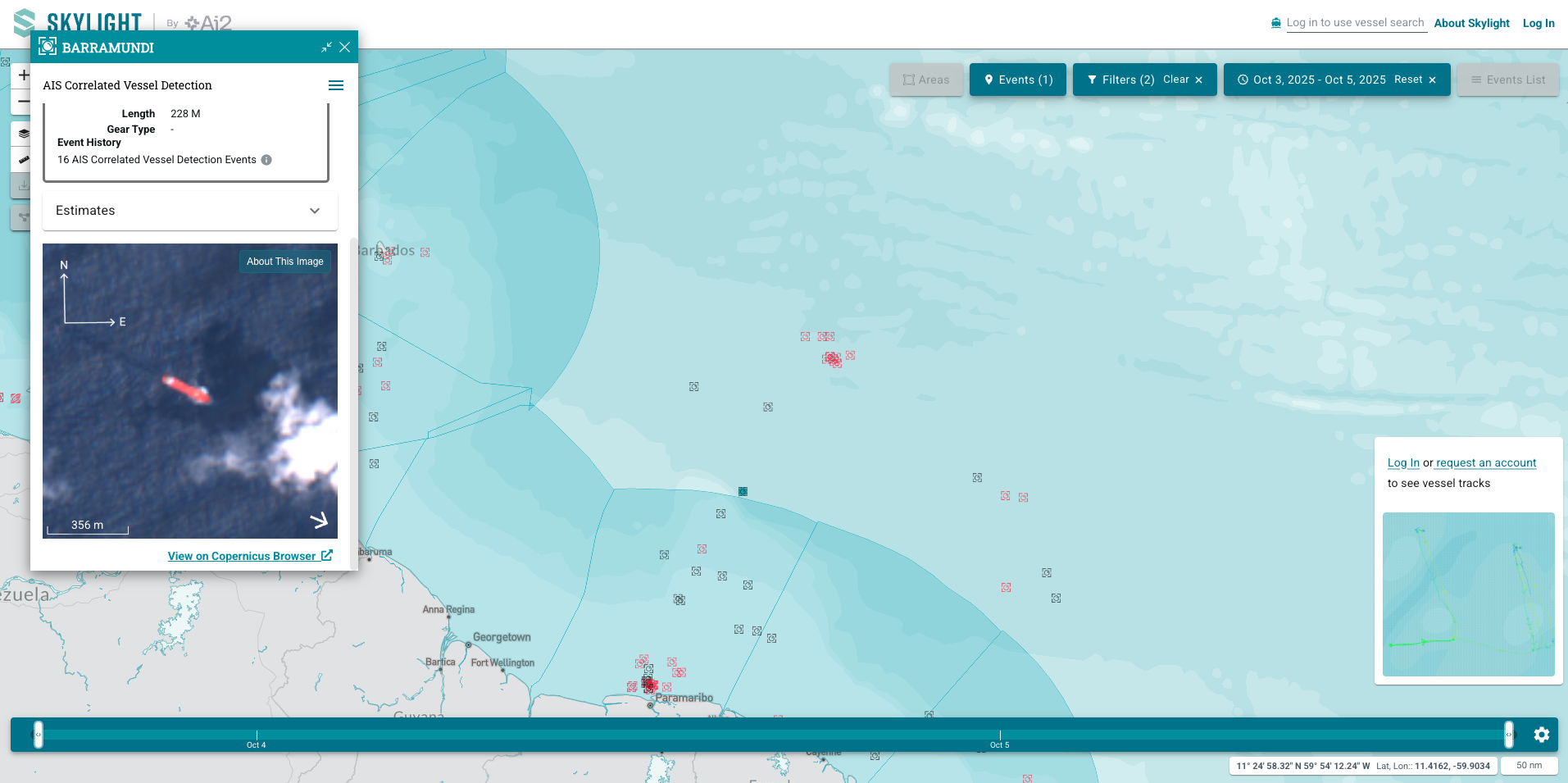
The Skylight Public Map provides anyone with a way to explore how AI transforms satellite data into insights about vessel activity at sea.
This version isn’t about real-time monitoring or enforcement; it’s a demonstration of Skylight’s technology. For the first time, anyone can interact with Skylight’s AI-powered vessel detections from public satellites, filter by imagery type, browse 18 months of historical data, and see the models we’ve built to help reveal maritime activity in some of the world’s most remote waters. A new feature even allows users to display vessel flags directly on the map, making patterns of movement more intuitive to explore.
Behind this experience is one of the most capable vessel detection infrastructures in the world. Skylight’s AI processes terabytes of satellite imagery daily, drawing from Sentinel-1, Sentinel-2, and Landsat 8/9, marking the first global use of these electro-optical satellites for vessel detection. Our system automatically identifies more than 1.3 million vessels per month or about 290,000 each week, from imagery alone. That scale matters. It provides concrete evidence that authorities and organizations need to make confident decisions, especially where resources are increasingly limited. These detections have supported the investigations from the largest IUU fishing seizure inside a marine protected area in Panama’s history to intercepts within Argentina’s Exclusive Economic Zone, real-world examples of how AI can strengthen enforcement.
Explore the map
Opening Skylight to the public builds on Ai2’s long-standing commitment to open research and transparency. The models behind Skylight’s vessel detections have been open-sourced and publicly available for some time, as detailed in our ArXiv paper, which describes how AI can detect vessels globally from satellite imagery. Today’s Public Map extends that openness by showing the impact of these models at scale, allowing anyone to see how advanced AI supports ocean conservation.
The Public Map isn’t a full monitoring tool. It intentionally omits AIS-based events, Areas of Interest (AOIs), and real-time tracking. Data is delayed by 48 hours, and detailed vessel information remains available only to authorized users. These safeguards protect sensitive operational data while still showing the core of what makes Skylight powerful: AI-driven analysis that transforms massive volumes of satellite data into actionable insight.
By making Skylight visible to all, we’re sharing more than a platform—we’re opening access to one of the world’s most advanced vessel detection systems. It’s a step toward greater transparency, collective understanding, and stronger protection for our ocean.