Skylight's Landsat vessel detection, rebuilt on OlmoEarth
A new model finds more vessels in Landsat imagery, including small boats that were too faint to pick out before.
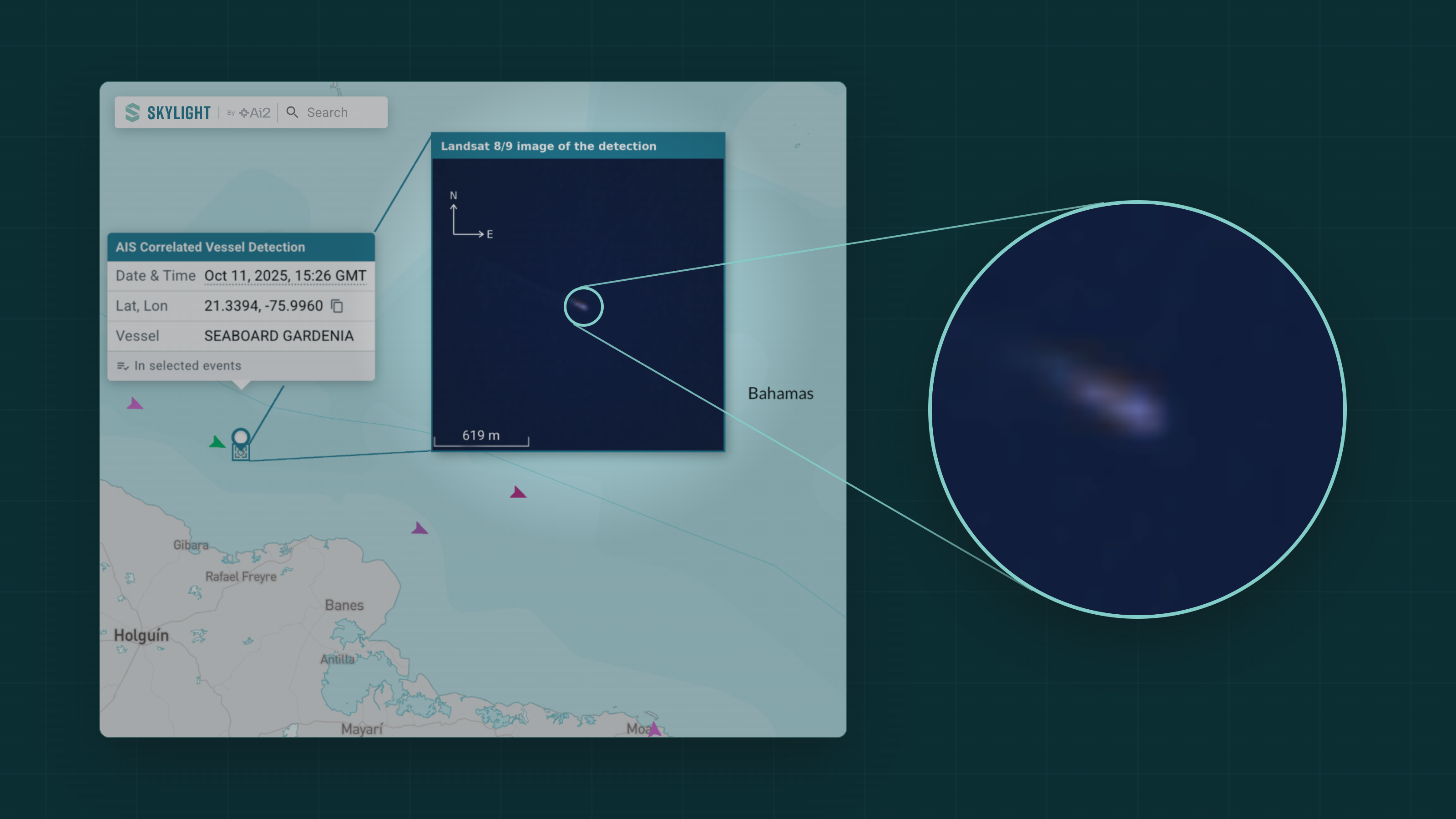
This fall, Skylight drastically improved the Landsat vessel detection model by building on Ai2's OlmoEarth foundation model and more than 1,000 ratings from our users. It now consistently finds vessels that many thought were too small to see. For Skylight users, that means more eyes on the water, more often.
Few thought vessels could be seen in low-resolution Landsat imagery. Designed to watch forests, farms, and glaciers, the NASA and USGS Landsat satellites hold the world’s longest-running record of Earth observation. At their resolution, a small boat can look similar to a whitecap or a chunk of ice. Skylight was the first to turn that imagery into real-time vessel detections in 2024, adding a layer for spotting vessels not broadcasting their position via AIS.
Adding Landsat to Skylight's optical sources for vessel detections roughly doubled how often we can look at a given area of water: from about every 4 days to about every 2 days. More frequent looks mean fewer chances for a vessel to come and go unseen.
Landsat also fills gaps that other satellite imagery (like Sentinel) leaves behind:
- The poles. High-latitude waters where Sentinel coverage is thin or non-existent get more regular optical passes.
- Small island states. Many island nations manage vast ocean territories with limited resources. Extra coverage helps them keep watch over waters far from shore.
Why is it so hard: the 30m problem?
Satellite images are made of pixels, the smallest units that, when put together, create a picture. In Landsat imagery, each pixel covers a patch of ocean 30 meters on a side, about the size of a blue whale. Even a large fishing boat fills only a few pixels, and many vessels are smaller than a single pixel, making them a challenge to detect.
- Small boats leave faint signals. A bright hull on dark water nudges that pixel's color, and a moving boat leaves a wake that stretches across several more. The signal is there, but it is faint.
- Lots of things look like boats. A vessel that spans two pixels shows up as a small smudge. So does a chunk of sea ice, a puff of cloud, or a breaking whitecap.
Finding faint bright spots is simple. Telling which ones are boats is what made Landsat vessel detection seem out of reach. Researchers at Ai2 started to crack the code with machine learning models in 2024, but too many false positives (e.g., detecting an ice block as a boat) made the model unreliable.
How OlmoEarth changed the game
OlmoEarth is Ai2's family of foundation models for Earth observation: general-purpose AI models that other tools, like Skylight’s new Landsat vessel detection model, are built on. OlmoEarth was trained on millions of satellite images, including Landsat. During training, OlmoEarth sees satellite images with patches hidden and has to fill in the gaps from what it can still see, as a game of fill-in-the-blank played across millions of images. Over the last three months, using this new model, Landsat added about 28% more vessel detections and removed most of the false positives.
Three things made the new Olmo-Earth model work better for vessel detection:
- A smarter starting point. We built our new Landsat vessel classifier on OlmoEarth v1.2. It outperformed the previous model, which started from a general image model trained on ordinary photos.
- Teaching it what is not a boat. The OlmoEarth team added 2,000 new annotations from two years of past detections, focused on the ice, clouds, and whitecaps that look most like vessels. These examples made a big difference in the model's ability to distinguish them.
- Feedback from our users. Skylight users can rate any vessel detection as accurate, inaccurate, or not sure. Over the past year and a half, you sent us more than 1,000 of those ratings. We tested candidate models against them and picked the one that best matched your expert input. In other words, your feedback directly shaped the model now running in Skylight. Thank you!
Skylight users are already seeing the difference. For the UK's Marine Management Organisation (MMO), Landsat has become another trusted way to confirm what is happening at sea:
"Through the Skylight platform, Landsat 8 and 9 have become a really useful addition to our remote-sensing toolkit. Together with improvements to Skylight's Landsat detection model, the data give us greater confidence in vessel detections and add another valuable source of information to our monitoring approach."
— Seb Jennings, UK Marine Management Organisation (MMO)
Keep the feedback coming
Keep rating detections. Every thumbs up or thumbs down helps us train and choose better models, just as it did this time. Questions or stories to share? Reach out to the Skylight team; we'd love to hear how you're using it.


